- January 3, 2017
- Internet of Things
Sensors are increasingly-valuable tools for better understanding, managing, and planning urban environments. In Chicago, for example, the city’s recently launched Array of Things urban sensor initiative has enabled simultaneous collection of data on a wide range of environmental factors such as air quality, weather conditions, noise, and traffic. Yet the Array of Things isn’t the only example of how sensors can enhance urban planning and management.
By combining sensors and cloud computing, a new pilot project in Chicago provides an innovative solution for what can be an everyday urban problem: rainwater. Launched by City Digital, a smart city incubator located within the consortium of public, private, and higher education entities that is UI Labs, the Smart Green Infrastructure Monitoring (SGIM) project aims to provide cities with a tool to reduce urban flooding and prevent millions of dollars in subsequent property damage. The effort represents a new way to address an old problem, and adds a level of strategy, efficiency, and effectiveness previously unavailable in stormwater management.
Understanding Stormwater Runoff
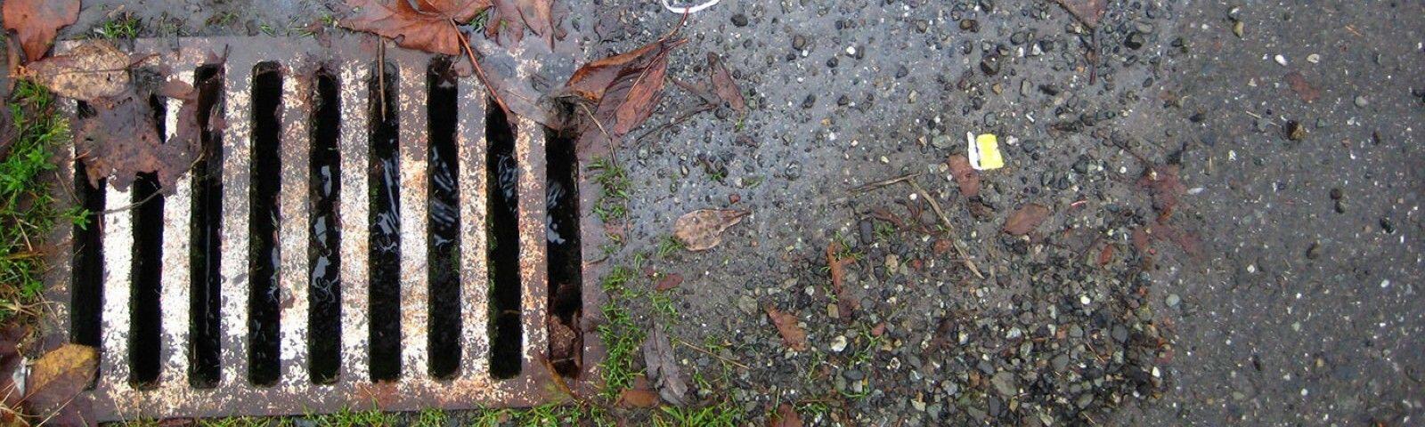
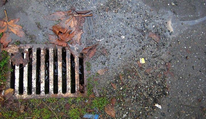
When rain falls to the ground in nature, water is absorbed and filtered by soil and plants. Yet in urban areas, the miles of paved surfaces and infrastructure mean that fallen rain, or stormwater runoff, can be a major problem. Water that runs off of surfaces instead of seeping into the ground carries pollutants such as trash, bacteria, and chemicals gathered from the urban landscape. Stormwater runoff can also lead to floods and the erosion of urban waterways, which can cause serious property and infrastructure damage.
Stormwater runoff is certainly not new: as far back as 2000 B.C., cities in the Mesopotamian Empire had practices for flood control, and even had methods for storing rainwater for household uses. These early systems have evolved to what we’re generally familiar with today: a system of sewers, pipes, and catch basins that deliver stormwater runoff to the nearest river, lake, ocean, or other body of water. Commonly referred to as gray stormwater infrastructure, these systems serve a single purpose: to divert water away from the built environment.
Yet most gray infrastructure was built at a time when storms behaved differently. Today’s storms, exacerbated by changes in climate, are often more intense, frequent, and localized. To more effectively manage these challenges, cities have turned to green infrastructure, which draws from nature to help manage stormwater.
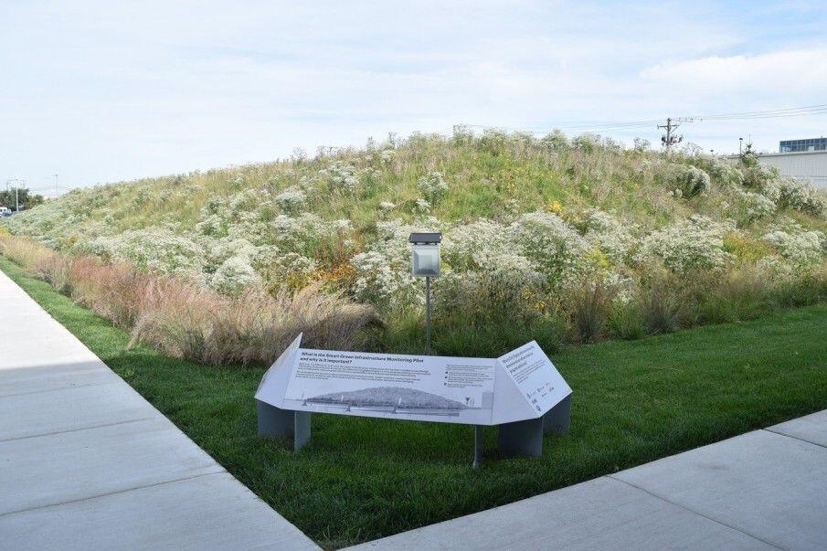
You’ve likely come across green infrastructure without even realizing it. Established examples include permeably-paved roads, which are built with water-pervious materials to limit stormwater runoff. Green roofs and rain gardens naturally absorb rainwater to reduce gray infrastructure’s load. And bioswales, which consist of curved landscape masses with gently sloped sides, are often placed near parking lots to help remove pollution from automobiles in rainwater.
In addition to naturally mitigating the harmful effects of stormwater runoff, these green infrastructure examples are generally cost-effective, too. The EPA maintains a list of financial analyses of green infrastructure initiatives from across the country, which shows savings gained in Maryland, New Hampshire, and Illinois, among other areas.
Given changes in climate and rainfall patterns, aging gray infrastructure, and the need for cost-effective alternatives, we know that green infrastructure is worth the investment. Yet precisely how effective are these efforts, and how effective can they be? How can a more detailed knowledge of green infrastructure’s impacts on stormwater runoff amounts lead to better strategizing, planning, and management? This is where sensors come in.
Integrating Sensors with Green Infrastructure
Take a walk down Chicago’s Argyle Street on the city’s North Side, and you’ll be greeted with rows of Vietnamese and Cambodian shops and restaurants welcoming locals and visitors. You’ll also be greeted with Chicago’s first “shared street” — a pedestrian-driven zone that blurs lines between walking and vehicle space to accommodate more room for walkers and cyclists. Less apparent will be the fact that you’re walking on one of the city’s newer permeably-paved roads – and one of the test sites for City Digital’s Smart Green Infrastructure Project (SGIM).
Underneath Argyle Street, City Digital and its partners have installed sensors to collect stormwater runoff data. These sensors can record, among other things, precipitation amounts, humidity levels, soil moisture measurements, air pressure levels, and chemical absorption rates. The site serves as an experimentation grounds for City Digital and its partners’ grand plan: to build a network of sensors that, combined with a platform for advanced computing and analysis, can serve as a tool for water challenge management and water infrastructure planning for years to come.
“Flooding is local, but its causes are system-wide,” David Leopold, City Digital’s Director of Program Management, said in the pilot’s official press release. “Through targeted deployment of green infrastructure across the larger system, cities can help address the flooding happening now and remain resilient in the face of future changes to climate and weather patterns.”
The pilot began in August of 2016, when its first sensors were installed at a bioswole located near UI Labs’ offices on Chicago’s Goose Island. Today, three locations are live, with SGIM sensors also in operation on Langley Avenue on the city’s South Side. The program will continue to expand in 2017, with two new locations on the way.
Together, these five sites will allow City Digital’s team, along with the City of Chicago, to analyze historical and real-time data and provide site-specific design recommendations for given settings. For the SGIM design team, which includes University of Illinois-based startup Senformatics, the pilot will also help inform what the best interface design for the final product should be.
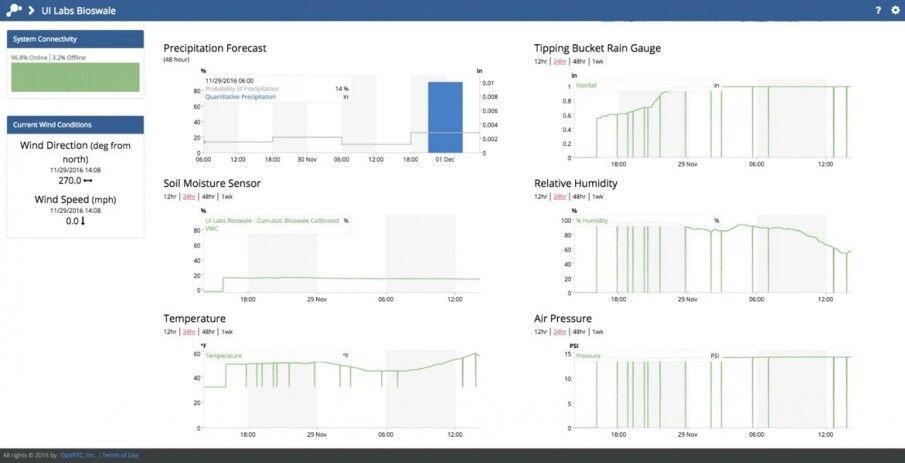
Brenna Berman, Chicago’s Chief Information Officer and a key public figure moving the project forward, envisions precisely how SGIM can help Chicago and other cities. “We would like to know at a high level whether the green stormwater infrastructure is working,” she recently said. “Is it preventing rainwater from entering the sewer system? Which designs work better in hard rains versus soft rains? Which work better during long storms versus flash floods?”
Like the city’s Array of Things initiative, SGIM’s data will also be publicly available on the city’s data portal in 2017. This will allow everyone, from residents to academic researchers to entrepreneurs, to directly interact with and derive insights from Chicago’s green infrastructure data.
The City Digital Approach at Work
2016 has been a landmark year for Chicago-based City Digital: SGIM is the second major smart cities pilot that the innovation lab has publicly launched. This fall, City Digital and its partners announced the launch of a new Underground Infrastructure Mapping (UIM) project, aimed at digitally mapping cities’ labyrinthine underground infrastructures. The UIM pilot required close collaboration with both the city’s Department of Innovation and Technology (DoIT) and its Office of Underground Coordination, who helped get things moving and permitted City Digital and partners to dig into the city’s streets.
Like UIM, the Smart Green Infrastructure Monitoring Project uses the city of Chicago’s built landscape as a testbed for experimenting with new technologies. Continued support from DoIT, as well as Chicago’s Department of Water Management and Department of Transportation, allow for such innovative work to happen. This “testbed access” that the city provides makes City Digital’s method unique, and also well-equipped to make technologies that can be replicated and scaled to cities around the world.
The other hallmark of City Digital’s work as an innovation lab, of course, is its collaborative, multi-partner model for getting initiatives like SGIM going. In addition to data management and design expertise from Senformatics, other partners for SGIM include Opti, a Boston-based stormwater technology firm, and Microsoft, whose Azure platform is supplying the project’s data and cloud capabilities.
SGIM: Looking Ahead
Ultimately, SGIM is a major step forward for one of City Digital’s most important areas of work: digitizing the water collection system. While green infrastructure systems have been positive developments for cities, no one has known what their exact overall impact has been on urban watersheds — for any unit of measurement.
Now, with SGIM, City Digital and Chicago hope to have a program that can enable monitoring of both green and gray infrastructure. Given changing weather patterns across the country and world, the project serves as a leading example of how cities can more effectively manage water.
Top photo credit Flickr/Phegg
 Sean Thornton is a Program Advisor for the Ash Center's Civic Analytics Network and writer for Data-Smart City Solutions. Based in Chicago and working in partnership with the city's Department of Innovation and Technology, Sean holds joint Masters’ degrees from the University of Chicago, in Public Policy and Social Service Administration. His work has spanned the city's public, philanthropic, and nonprofit sectors.