- July 23, 2018
- Data Visualization
Finally: Someone out there is interested in hearing you complain about your commute.
At the end of April, the transportation division for Brookline, Massachusetts posted a roadmap on the town website and invited residents to report intersections, road signs, sidewalk obstructions, or anything else that caused them trouble. The town introduced the map as part of its effort to complete the second tier of the application to receive funding through Massachusetts’s Complete Streets Program, which provides assistance to cities and towns working to make their streets accessible to everyone, regardless of their age, ability, or mode of transportation.
It worked like this: Residents could place one of five types of pins (Accessibility, Bicyclist, Pedestrian, Transit, or Driver) on the map and add a comment explaining the problem. Other residents could also add comments to the pin to further elaborate the original complaint.
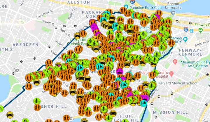
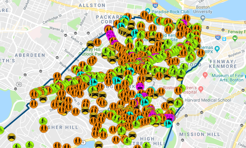
The division expected to receive 100 responses. When the map closed for input in late June, they had received 740.
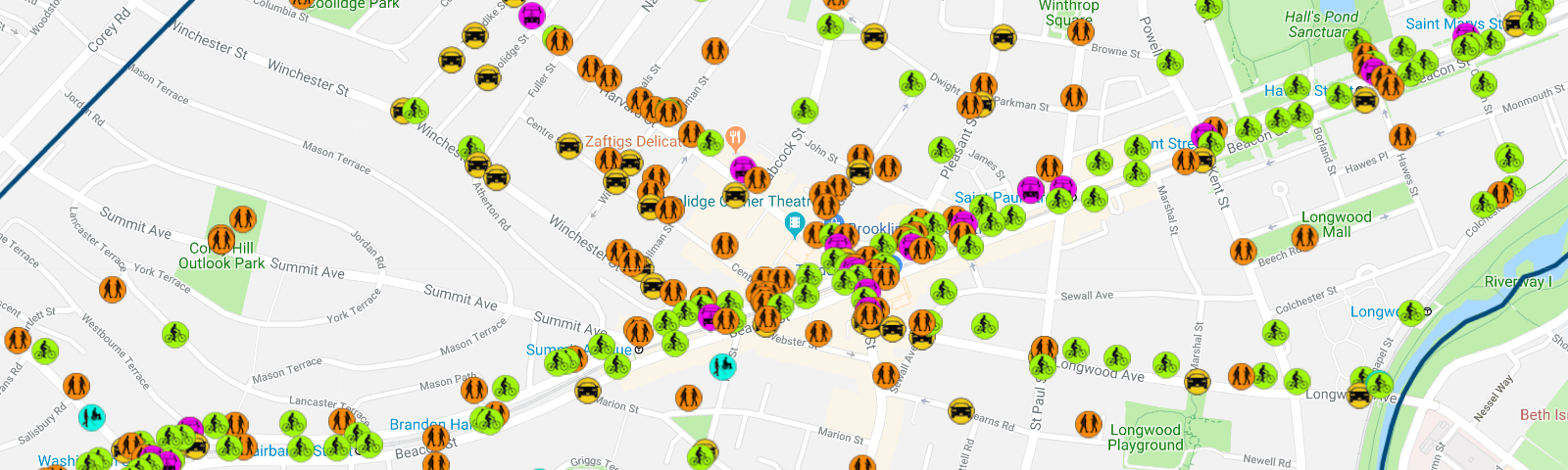
The result is a detailed portrait of a town on the move, bumps and all. At first glance, it’s easy to notice the ‘X’ cutting across the northern end of Brookline, produced by complaints made along Beacon St., Harvard St., and Longwood Ave.
According to an article published by Wicked Local Brookline, this does not surprise anyone. Brookline has been working on traffic calming policies for a decade, so members of the town government are already familiar with the general areas of concern. Nevertheless, it’s always good to confirm one’s suspicions, and the map certainly provides the opportunity to do so. Beyond that, the detail and the specificity of the input from residents provide insight into the smaller, fundamental problems that underpin larger traffic issues.
For example, at the intersection of Beacon of Harvard, you can find an assortment of pins dropped complaining of specific problems experienced by pedestrians, bus passengers, and bicyclists.
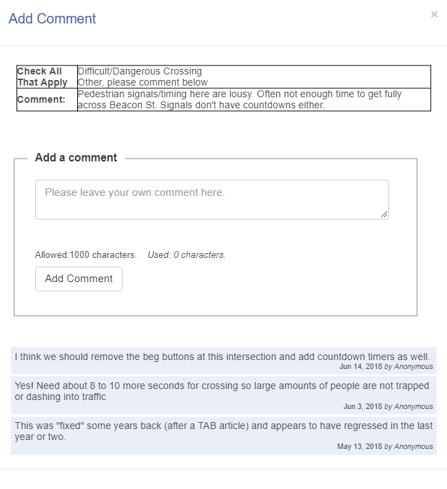
One pedestrian writes, “Pedestrian signals/timing here are lousy. Often not enough time to get fully across Beacon St. Signals don't have countdowns either.” To that comment, three others responded with agreement or suggestions to improve the situation.
Two pins dropped by bus passengers are in agreement: The Green Line should have signal priority along Beacon.
And one bicyclist writes, “Many bikes turn left from Harvard (in both directions) onto Beacon. There should be a safe, legal way to do this. I see these left turns attempted in many different ways.”
Comments left a little farther off the beaten path are equally informative. A resident reports that telephone poles along Cottage Road make the sidewalk impassable for wheelchair users and parents with strollers. Curious, I checked Google Street View to see if they were right. Lo and behold:
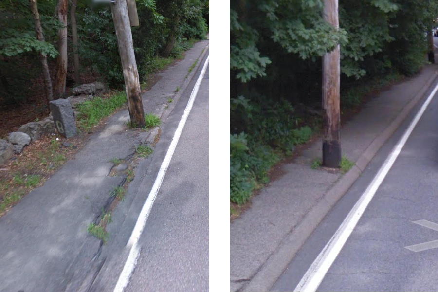
Good people of Brookline, if you are reading, take this not as an instance of public sidewalk-shaming, but a testament to the immense usefulness of the tool you have wrought. After only two months of submissions to their wikimap, the transportation division of Brookline has stockpiled a veritable trove of public input—far more than what it could gather through public meetings alone—and the briefest of surveys confirms that the input received is accurate, is detailed, is useful.
The citizens of Brookline, Massachusetts are more than willing to do the work of surveyors and inspectors, and of that work they have demonstrated themselves to be more than capable. Truly, it’s just a matter of making it easier for them to be heard—of lowering the threshold of effort required to transform daily moments of annoyance and aggravation into pertinent, accessible, and actionable information.
The second, and most vital step, is to respond. The map, at least in concept, affords Brookline the opportunity to do so. For instance, using the same interface, town officials could respond to residents’ comments, either to provide updates on repairs, or simply just to let them know that they’re listening to what they have to say.
Brookline’s traffic wikimap was originally created for the specific purpose of an application for state funding. Now, all signs point to its lasting utility.
 Daniel is a Summer Research Assistant/Writer for Data-Smart. He graduated from Williams College with degrees in Philosophy and Mathematics.


