- Map
- City of Atlanta
- Data for Science and Public Policy
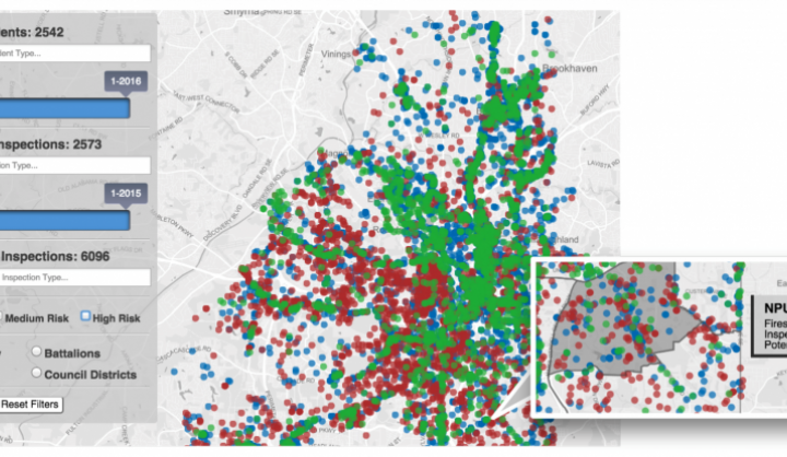
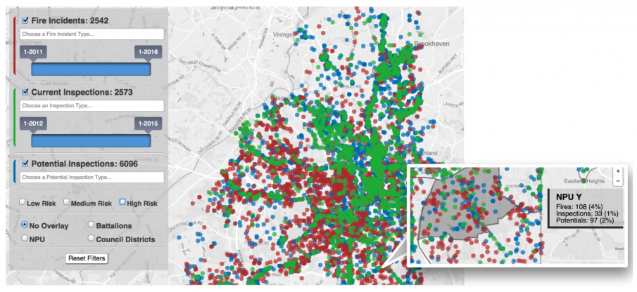
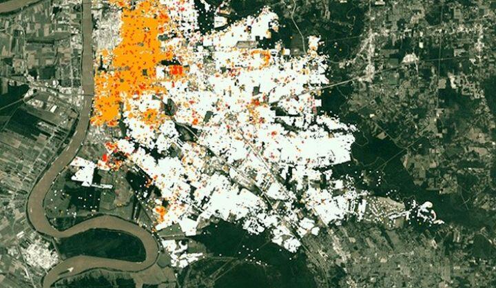
In Atlanta, the fire department enlisted local Data Science for Social Good analysts to identify commercial properties missing from its inspections list. This new list, as discussed above, was vastly longer than the original one. Seeing the need to prioritize inspections, the department asked for a risk-based list of properties to inspect. Firebird is a framework designed to help municipal fire departments: Discover new properties for inspection Prioritize those properties by their fire risk Visualize property inspections on an interactive map Improve all aspects of the inspection planning process The analysts trained an algorithm to find how attributes like buildings’ size, condition, location, and age had contributed to the distribution of past fires, and to predict future ones. They had hidden a subset of fires—the most recent year’s—from the model, then used those fires to test how well the predictions would perform.
DATASETS
Open data (fire incidents, fire permits, cirme incidents, liquor and businesses licenses, socioeconomics and demographics, commerical properties, parcel conditions)
PARTNERS
Georgia Tech