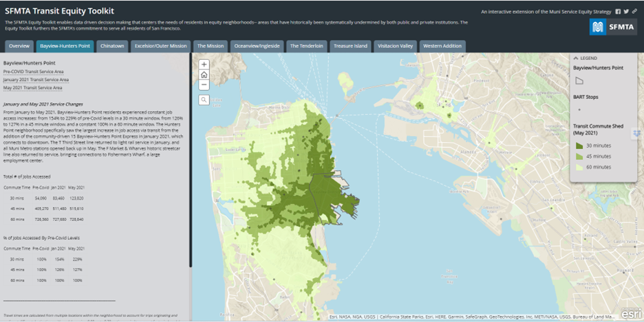
- Map
- Forest Preserves of Cook County
- Smart Chicago


The Forest Preserves of Cook County partnered with Smart Chicago to produce a web map that allows visitors to easily plan trips, navigate preserves and trails, and discover new opportunities. It extends the OpenTrails data specification and open source Trailsy/Trailsy Server code bases originally developed by Code for America. The custom web map launched in March 2017 and informal feedback has been overwhelmingly positive. The FPCC is using Google Analytics to track website traffic patterns and specific user events that, over time, can be used as proxies for actual preserve visits. The FPCC will conduct additional user testing and surveys this summer.
DATASETS
The map relies on existing and newly created data sets from the Forest Preserves of Cook County, adapted to the Open Trails specification (or building off of the specification where no guidance exists). It includes open data sets adapted from the Cook County Open Data Portal. Underlying data available here: https://github.com/fpdcc/webmap_data_updates OpenTrails specification: http://www.opentraildata.org/