- Map
- Global
- World Resources Institute
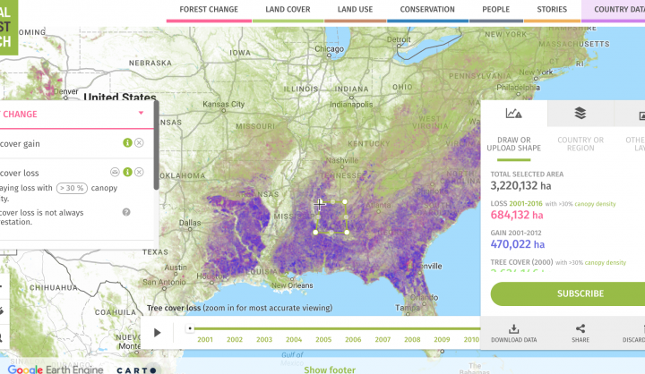
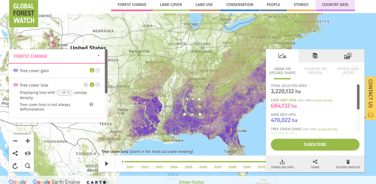
A web-based tool, Global Forest Watch, aims to provide a "near-real time" view of deforestation (and reforestation) around the world. The program, which is provided by World Resources Institute, allows unprecedented visualization of deforestation. With the exception of Brazil, none of the tropical forest countries have been able to report the state of their forests. Now it will be possible to have near real-time updates of the state of the world's forests, open to anyone to use. The web tool uses more than half a billion high-res images from NASA's Landsat program, which are organized with new algorithms created by the University of Maryland, and then made available for easy online access thanks to the cloud computing power of Google's Earth and Maps engines. Users and watch groups can collect information as well as "submit data, pictures, and video on the ground." The benefits of this crowdsourcing ability is a "near real-time" monitoring of existing tree cover anywhere in the world.
DATASETS
NASA's Landsat program, Google, crowd-source


