- Map
- State of Indiana
- Management Performance Hub


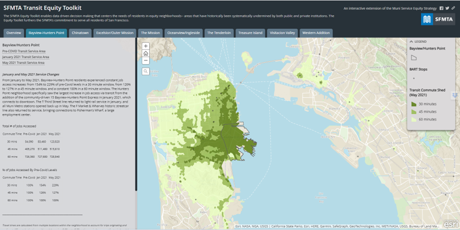
The Indiana Crash Risk Map is an interactive tool that predicts where crashes are likely to occur across the state of Indiana. Users have the ability to select a three hour time window throughout the current day and the map will update to depict areas of risk on roadways across the state. As the user zooms in, prior crash sites become visible to help pinpoint locations of risk within the area the user is interested in exploring. The Indiana State Police, in conjunction with the Indiana Management and Performance Hub, is pleased to provide this powerful tool for the reduction and prevention of vehicle crashes on Indiana roadways.
DATASETS
Indiana State Police
PARTNERS
Indiana State Police