- Map
- United States
- Dartmouth College
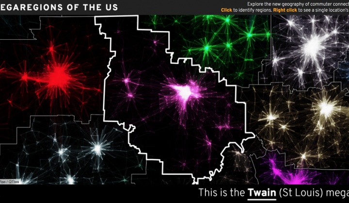
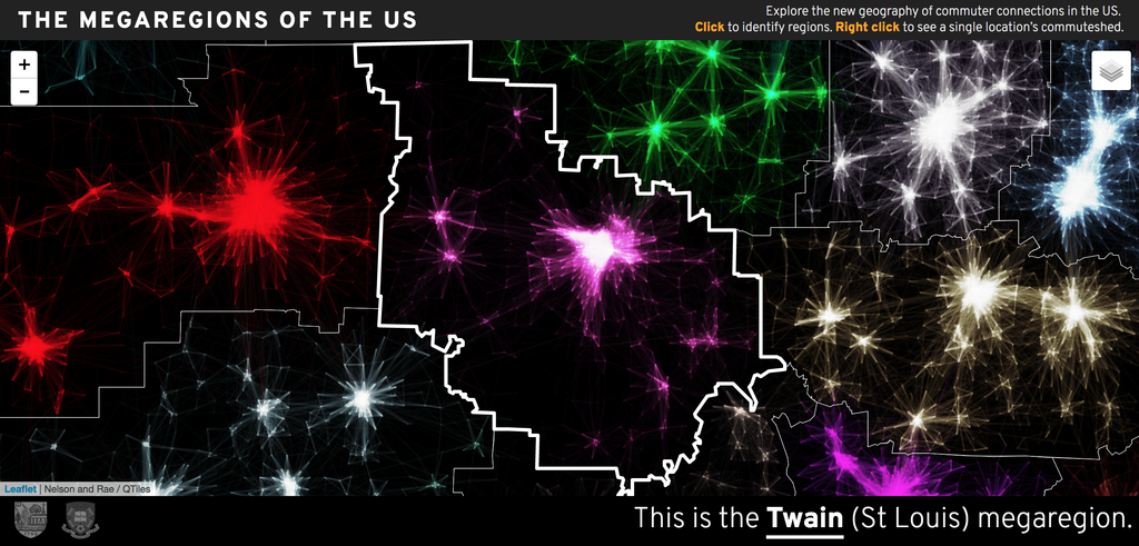
Researchers analyzed 4 million point-to-point commutes, representing 130 million travelers, sculpting the data to show the heaviest volumes of daily flows. This process revealed constellations of neighboring cities, connected by interlocking workforces-a new way of visualizing America's megaregions, a concept that has lately gained steam among planners and economists. On this interactive map, users can zoom in state by state, zone by zone, to see how urban economies transcend city limits.
DATASETS
American Community Survey, commuter tracking software (unspecified)