- Map
- City of San Jose
- San Jose Department of Public Works
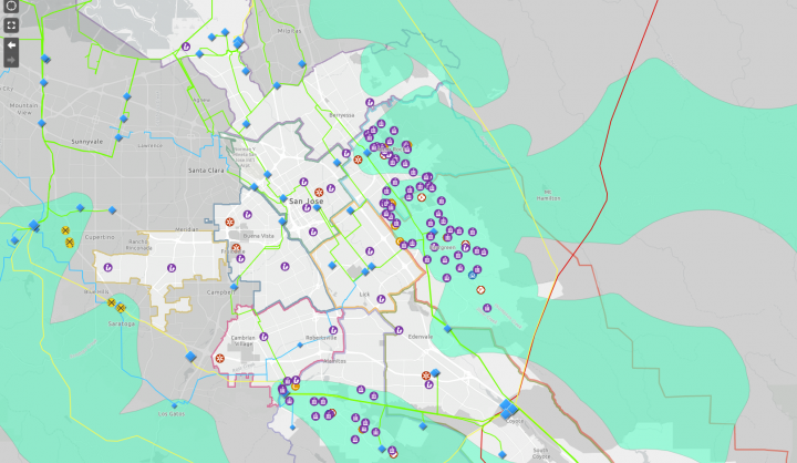
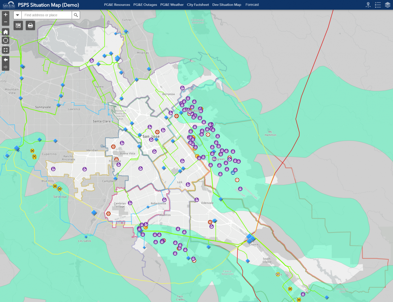
This map is meant to assist first responders in San Jose to reach out to residents in need during power outages in wildfire season, and allow residents to communicate with city officials about which areas in the city have power.
Datasets
Datasets from San Jose’s Spatial Data Repository, data feeds from several San Jose data systems, Internal customer information from PG&E, data collected from San Jose residents during power outages via online surveys